|
||||||||||
|
|
||||||||||
|
||||||||||
|
|
||||||||||
As we have discussed in a previous article, the term contrail is short for condensation trail. These trails typically form because of the interaction of a vehicle's exhaust with the ambient air at altitude. The air at high altitudes is generally cold and dry while the exhaust from aircraft engines and rocket motors is hot and humid. As these fluids mix, the water vapor of the exhaust freezes in the cold ambient air to form ice crystals. These ice crystals leave a white cloud-like trail behind the vehicle as it travels across the sky.
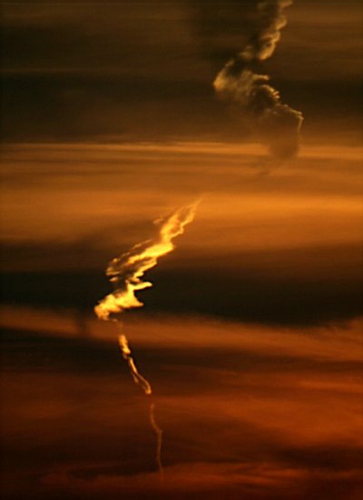
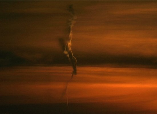
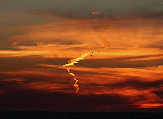
The behavior we see in the photos you have provided is actually not that unusual. What these pictures appear to show is a contrail that is being deformed by winds. The wind may be blowing more strongly or in a different direction over the length of the contrail causing it to be pulled apart. This situation is particularly common if the contrail was formed by an aircraft or rocket as it was climbing. As altitude increases, wind speed generally increases. The portion of the trail formed at lower altitudes may move very little while portions at higher altitudes are often blown further away, stretching the contrail out as shown in the pictures.
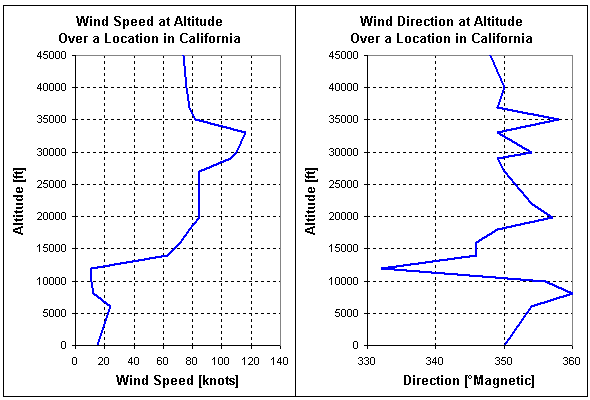
The following graph represents actual experimental data measuring wind speed and direction from sea level up to 45,000 ft (13,715 m). This data was collected by an aircraft flying over a region of southern California on a day in early March 2006. The measurements demonstrate how the speed and direction of the winds vary as altitude increases. The profile indicates that the wind was blowing nearly due south at most altitudes. The wind speed, however, varied considerably more from around 15 knots near the ground to over 115 knots at high altitude.
These photos you have provided appear to show a contrail left by a vehicle climbing from sea level to high altitude. The deformation of the contrail shape further indicates that the wind speed is increasing with altitude and pushing the central portion of the contrail towards the right.
While such a contrail could have been left by an aircraft making a rapid zoom climb to high altitude, several characteristics of the contrail make it more likely to have been created by a rocket. For example, some regions of the contrail appear to be expanding outward compared to the diameter immediately below. This characteristic is common on rockets when the previous stage burns out and a new stage is ignited.
When we originally received these photos, we suspected that the contrail might have been left by a rocket launched from Vandenburg Air Force Base. Vandenburg is a primary site for launching Air Force rockets that carry military satellites into orbit. The base is located along the California coast north of Los Angeles, and the rockets launched from this location travel southwest over the Pacific Ocean. Since the photos were taken from San Francisco looking towards the southwest, they could have been taken while looking directly towards the flight path these rockets usually travel. Launches from Vandenburg are often visible from several hundred miles away, so it is very possible that the photographs show the contrail left by such a rocket.
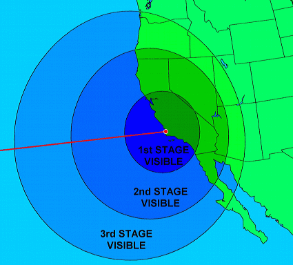
We obtained a second opinion from Brian Webb who maintains a website describing how to identify and photograph
Viewing Vandenberg Rocket and Missile Launches. Brian
felt that the contrail shown in these photos was probably not a Vandenburg launch given the time at which it was
taken but could be a missile or sounding rocket launched from a ship at sea. Sounding rockets are used to collect
atmospheric data like temperature and winds at increasing altitudes. Be sure to visit Brian's site for more
information on this subject and a variety of other astronomy topics.
- answer by Jeff Scott, 19 March 2006
Read More Articles:


|
Aircraft | Design | Ask Us | Shop | Search |

|
|
| About Us | Contact Us | Copyright © 1997- | |||
|
|
|||